


Although Kocaeli has been a manufacturing hub in Turkey since 1843, it faces critical risks such as unplanned growth, pollution and active fault lines. YEOSB is safeguarding this legacy by addressing the reality of earthquakes and driving technological transformation. Kocaeli İçin Stratejik Önem Deprem Güvenliği: Aktif fay hatları üzerinde yer alan bölgede, üretim sürekliliğini koruyan depreme dayanıklı mühendislik çözümleri sunar. Yeşil ve Dijital Dönüşüm: Sanayi ve Teknoloji Bakanlığı hedefleriyle uyumlu, %80 enerji verimliliği odaklı ve karbon nötr "Yeşil OSB" modelini hayata geçirir.
YEOSB
Kocaeli’s Industry 5.0 and Earthquake Safety
Urban Planning: Relocates industry currently confined within the city centre to a smart ecosystem integrated with the Sabiha Gökçen Airport, railway and port corridors. Küresel Rekabet: Yapay zeka ve otonom sistemleri insan odaklılıkla birleştirerek Kocaeli’nin Endüstri 5.0 standartlarında bir teknoloji üssü olmasını sağlar.
The Kocaeli Fault Activity Research Project (Kocaeli Metropolitan Municipality)
Based on the fault map prepared by our department using MTA data in a digital AutoCAD environment, and taking into account the faults and their characteristics, we will draw up development and sound urban planning schemes. Work is currently underway to prepare projects addressing the earthquake-generating potential of these faults.

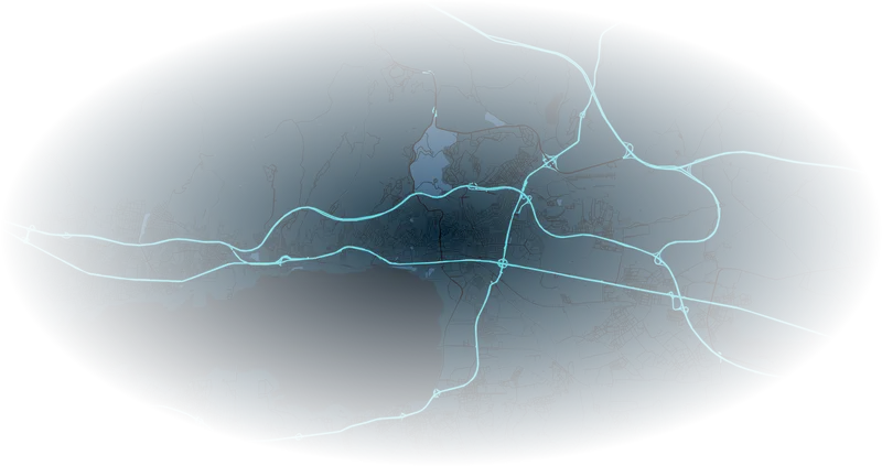
With a total area of 3,397 km², Kocaeli is the seventh-largest province in Turkey in terms of land area. The Gulf of Izmit, a natural harbour, is a busy sea route.
The seismic risk facing the city of Kocaeli is not limited to this. Within the boundaries of Kocaeli Metropolitan Municipality, the districts of İzmit, Kartepe, Başiskele and Gölcük are situated on active fault lines or zones. From this perspective, the importance and urgency of carrying out the necessary work not only in the provincial centre but across the entire city are clearly evident. The 17 August 1999 Gölcük and 12 November 1999 Düzce earthquakes caused significant damage in Kocaeli. The main reasons cited for this were the magnitude of the earthquakes, as well as poor building quality and ground amplification.
GEOLOGY AND TOPOGRAPHY The provincial capital of Kocaeli is situated on a plain between the Samanlı Mountains to the south and the Istanbul-Kocaeli Uplift to the north. The current topography of the Kocaeli region has been shaped by tectonic depressions, such as the Izmit Bay and Lake Sapanca, and changes in sea level. This depression, which contains a significant amount of settlement, has been entirely filled with alluvial deposits carried by rivers.
The boundaries between the mountainous areas, composed of rocks of different geological ages, and the plain are represented by faults in many places. WHERE ARE THE ACTIVE FAULTS IN KOCAELI? According to the TDFH, the northern branch of the KAF extends from the west of Lake Sapanca to Kazakburun, Tepetarla and Basiskele, entering the Gulf of Izmit; from there, it passes along the coast of Gölcük and extends into the Sea of Marmara. The 17 August 1999 earthquake caused surface faulting along the active main branch of the fault between Gölcük and Sapanca (Figures 3 and 4). The NE-SW trending faults located in the northern parts of the province are likely inactive, i.e. they do not generate earthquakes (Figures 4 and 5). Figure 4 – Active faults passing through and near the centre of Kocaeli Province, according to the Turkey Active Fault Map. The locations of the faults that ruptured during the 17 August earthquake (see Figure 3) have been mapped in considerable detail.
Nevertheless, as the exact locations of some faults are not precisely known, all faults are shown as 100 m-wide bands. Figure 5 – Simplified subsurface structure of the Izmit Bay–Kocaeli area: Red lines indicate faults. Light brown areas indicate rock units of different ages and types, whilst yellow areas indicate weak ground and alluvium. The mapping of active faults is carried out through paleoseismological studies based on geological engineering, incorporating data from various disciplines.
By mapping the locations of active faults with sufficient accuracy to serve as a basis for town planning, it is possible to determine the magnitude and frequency of earthquakes they have produced in the past, and consequently, the determination of probabilities regarding when and of what magnitude earthquakes may occur in the future, is possible through geological, geophysical, geodetic, geomorphological, and the associated paleoseismological studies.